Convenient and safe service guaranteeing participants, of purchase, and sale of art and antique objects. A 100% money-back guarantee if the order is not completed or the product does not meet the description. For more details, see FAQ
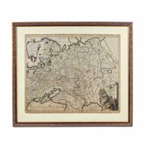
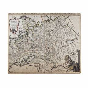
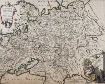
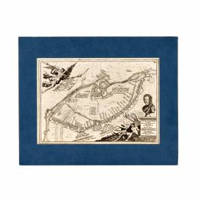
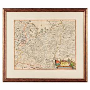
Map of Russia at the end of the 17th century. JAILLOT, HUBERT, Nova Russiae albae sive Moscoviae ... La Russie Blanche ou Moscovie. Amsterdam (Mortier) late 17th century. Colored engraved map. Dimensions of the card: 50x60 cm.
Location: Gallery "Antiqon", Brivibas street 52, Riga, Latvia
Warranty: Seller Warranty
Country: Russia
Period: The end of the 17th century
Item description is approximate automatic translation . Antiqon.com is not responsible for translation errors. Show original text.
Карта России конца 17 века.
Карта России конца 17 века. JAILLOT, HUBERT, Nova Russiae albae sive Moscoviae ... La Russie Blanche ou Moscovie. Амстердам (Мортье), конец 17 века. Цветная гравированная карта. Размеры карты: 50х60 см.
machine translation
Do you have a similar item? Want to sell it ?
Fill out the description of your item, attach high-quality photos of it, and set an affordable price. After moderation, your ad will go to the Antiqon online catalog and will be available to collectors from all over the world.