Convenient and safe service guaranteeing participants, of purchase, and sale of art and antique objects. A 100% money-back guarantee if the order is not completed or the product does not meet the description. For more details, see FAQ
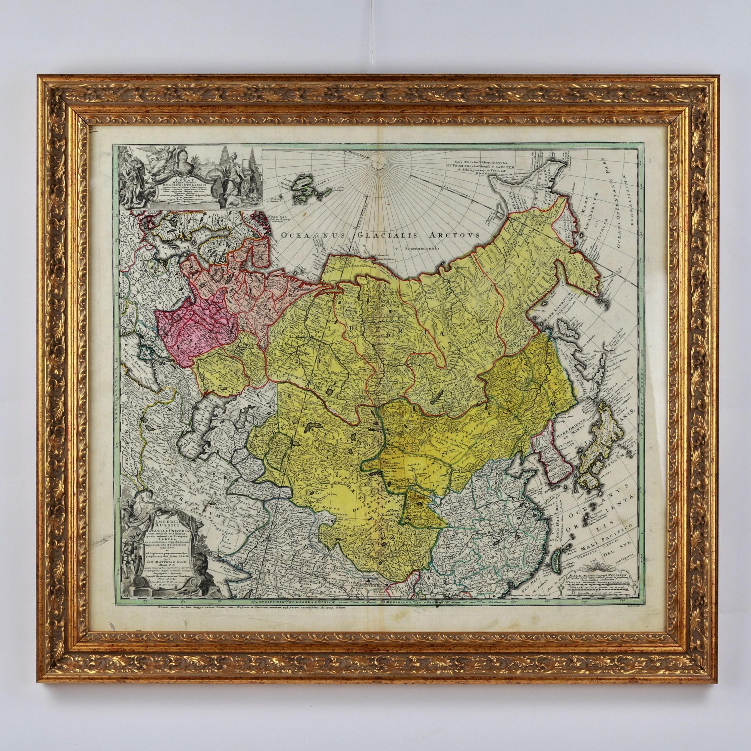
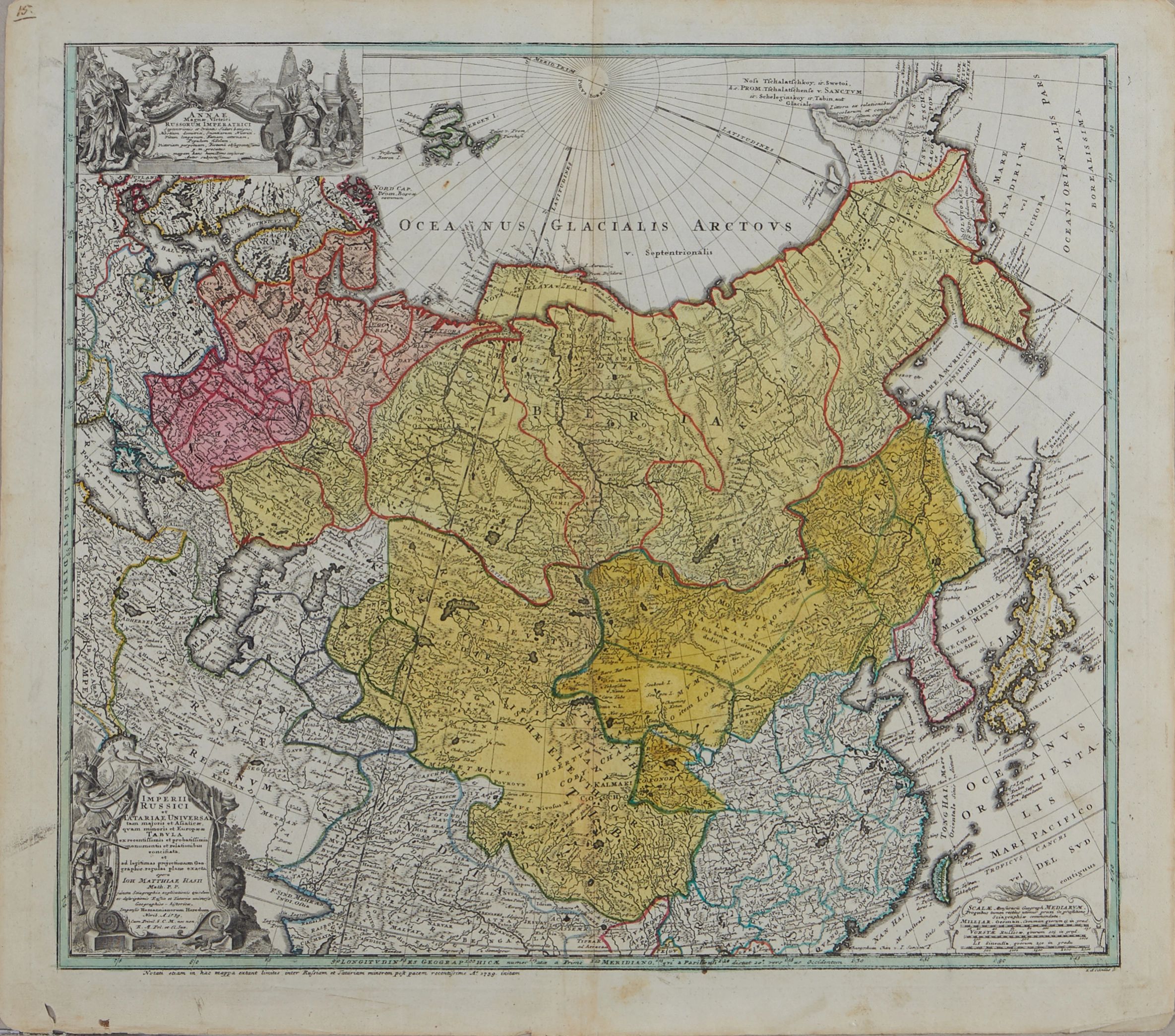
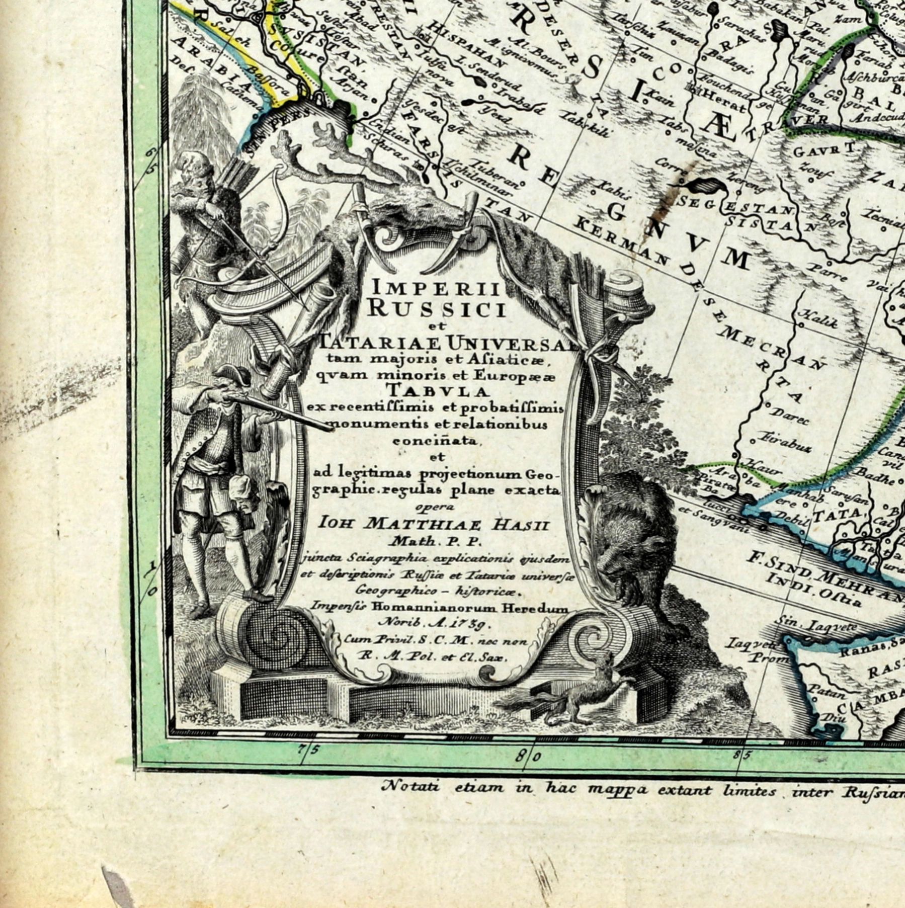
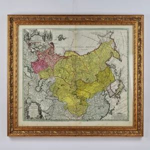
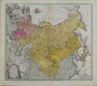
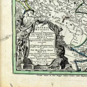
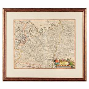
Geographical map of the Russian Empire. Nuremberg (Jan Jansson) 1730-39
Geographical map of the Russian Empire during the reign of Anna Ioannovna Romanova. Made in Nuremberg (Jan Jansson) in the period 1730-1739. Colored engraved card with 2 cartouches in black and white. Engraving by S. Dorn. Unframed size: 52 x 60 cm.
Location: Gallery "Antiqon", Brivibas street 52, Riga, Latvia
Item description is approximate automatic translation . Antiqon.com is not responsible for translation errors. Show original text.
Географическая карта Российской империи. Нюрнберг (Ян Янссон) 1730-39
Географическая карта Российской империи в период правления Анны Иоа́нновны Романовой. Изготовлена в Нюрнберге (Ян Янссон) в период 1730-1739 гг. Цветная гравированная карта с 2 картушами в черном и белом цвете. Гравюра С. Дорна. Размер без рамы: 52 х 60 см.
machine translation
Do you have a similar item? Want to sell it ?
Fill out the description of your item, attach high-quality photos of it, and set an affordable price. After moderation, your ad will go to the Antiqon online catalog and will be available to collectors from all over the world.